Rapid Response: 3D Laser Scanning in Charlotte, NC

Sometimes, a project simply can’t wait. At GTEC3D, we pride ourselves on rapid mobilization to meet critical deadlines—even when it involves a last-minute flight and a next-day deliverable. Our most recent mission took us to 

Charlotte, North Carolina, where we executed a high-stakes capture to provide a digital foundation for a time-sensitive project.
eal-time precision: A Leica Cyclone FIELD 360 screenshot showing the beautifully accurate pre-registered scan data of the old Lowe's Head Office before export.

From Tarmac to Tripod in Record Time

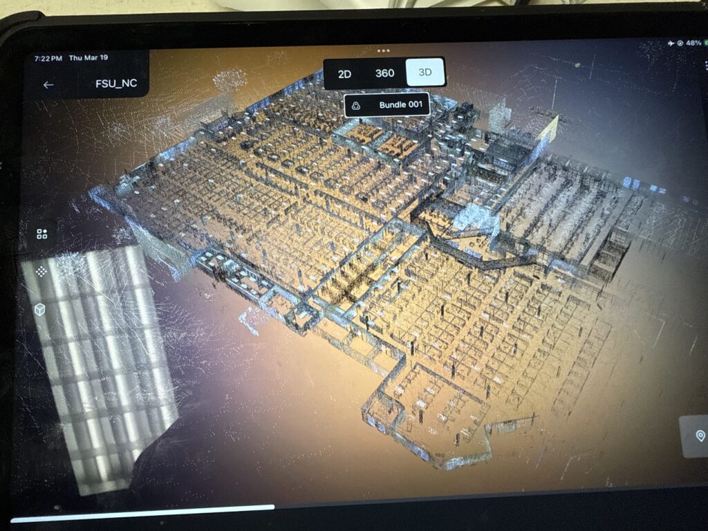
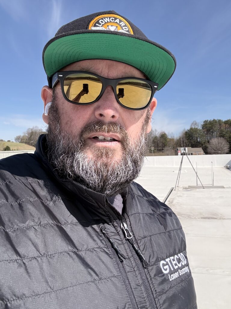
When the call came in for an urgent scan in the Charlotte area, there was no time for standard logistics. I jumped directly on a plane to get boots on the ground. The mission: deliver a high-fidelity digital twin with zero margin for error.
 
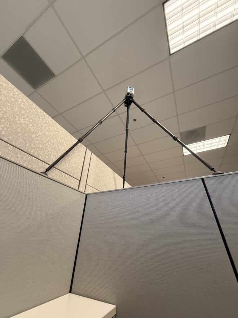
For this specific task, speed and precision were paramount. We deployed the Leica RTC360 a powerhouse in reality capture capable of measuring up to 2 million points per second. Thanks to its Visual Inertial System (VIS), the scanner automatically tracked its own movement between setups, allowing us to pre-register the data in the field and drastically reduce office processing time.
Leica RTC360 3D laser scanner mounted on office dividers during a rapid-response survey at the former Lowe's Corporate Headquarters in North Carolina.
Precision in the office: The Leica RTC360 capturing high-density point cloud data at the old Lowe's Head Office in Charlotte to create an incredibly accurate Matterport site.

The Workflow: Leica Precision Meets Matterport Accessibility

While the 
Leica RTC360
 
 is known for its survey-grade accuracy, the client required the immersive, user-friendly interface of a Matterport digital twin for their stakeholders. To bridge these two worlds, we utilized a high-performance workflow:
 
  • Precision Capture: Each scan was completed in under two minutes, including high-resolution HDR imagery.
  • E57 Export: All captured scans were exported in the E57 format—the industry standard for high-density point clouds.
  • Matterport Integration: By uploading these E57 files to the Matterport platform, we provided the client with a model that is 10 to 20 times more detailed than a standard MatterPak.
Hazard of the job: A local bird in Charlotte decides our RTC360 looks a bit too much like lunch during our last-minute site capture.

Why This Matters for Charlotte Projects

Charlotte’s rapid urban development requires data that is both fast and incredibly accurate. By combining survey-grade hardware like the 
RTC360 with the accessibility of Matterport, we ensure that:
 
  • Architects and Engineers get the millimeter-level accuracy they need for design.
  • Project Stakeholders can virtually walk through the site from anywhere in the world.
  • Deadlines are met through accelerated field-to-finish workflows.


At GTEC3D, we don’t just capture data; we capture peace of mind for our clients, no matter how tight the schedule.
 
Do you have a time-sensitive project in North Carolina or beyond? Contact GTEC3D today to see how our rapid mobilization can keep your project on track.
A GTEC3D technician wearing a branded high-visibility safety vest operates a Leica RTC360 laser scanner during a site survey at the old Lowe’s Head Office in North Carolina.
New gear, same precision: Repping the GTEC3D merch while capturing survey-grade data for an accurate Matterport digital twin.

Leave a Reply

Your email address will not be published. Required fields are marked *